Severe Storms Expected This Weekend as Amber Warning Hits UK
Meteorologist Sarah Kent warned of “severe thunderstorms with frequent lightning, hail up to 2cm, and gusts reaching 60mph,” particularly in southeast England, including London, Kent, and Hampshire, where the worst impacts are expected this evening. Northern England, including Manchester, Leeds, and Sheffield, faces intense rainfall of 50-80mm in under three hours on Sunday, while Edinburgh and Glasgow are braced for heavy showers. The Environment Agency has issued 25 flood warnings, with rivers like the Test, Itchen, and Severn at high risk due to saturated ground following England’s driest spring since 1976.
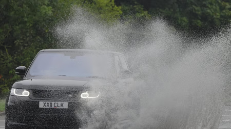
The amber warnings, a step up from earlier yellow alerts, indicate a “danger to life” from fast-flowing floodwater and lightning strikes. National Rail has reported cancellations on routes such as London to Brighton and Manchester to York, with Network Rail urging passengers to check updates. The RAC warned drivers to avoid flooded roads, advising, “Turn around, don’t drown.” Southern Water, amid a hosepipe ban in Hampshire, noted that while rainfall could ease reservoir strain, “short-term deluges risk overwhelming drainage systems.”
Social media is abuzz with X posts tagged #UKStormChaos, showing flooded streets in Surrey and downed trees in Norfolk. Users like @WeatherNerdUK shared clips of lightning illuminating London’s skyline, while @FarmersVoice warned of crop losses in East Anglia. The Met Office highlighted climate change as a driver of intensified storms, with warmer air fueling heavier rainfall.
